
Soil Type Mapping of Bangladesh
Through a wide variety of mobile applications, we’ve developed a unique visual system.
- Software ArcGIS Pro
- Date 20/04/2025
- Data FAO Soil Data
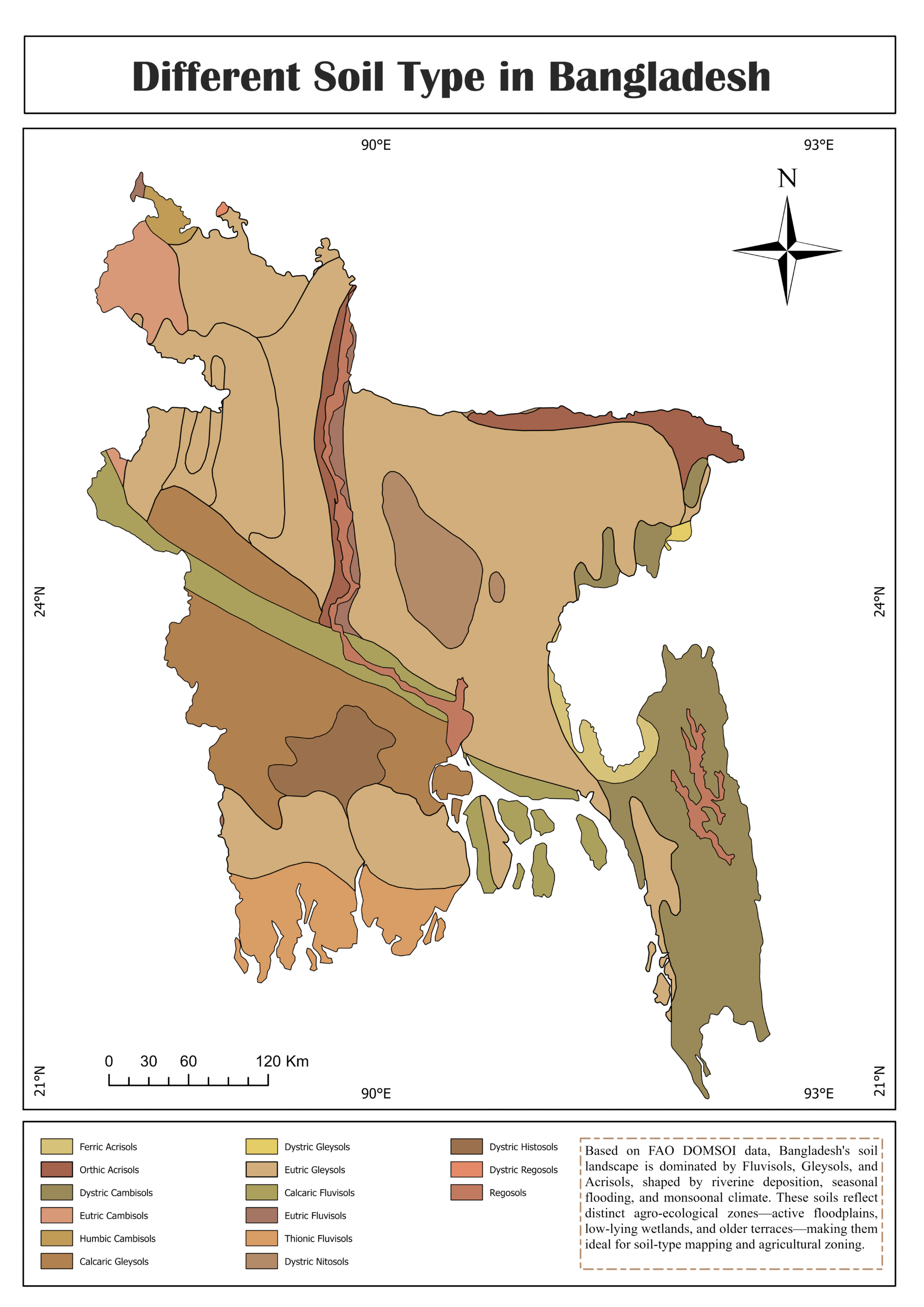
This project presents a high-resolution soil type map of Bangladesh using FAO’s global soil dataset and the DOMSOI classification system. Developed in ArcGIS Pro, the map highlights the spatial variability of soils and supports evidence-based decision-making for sustainable agriculture, climate resilience, and environmental planning. The result is a visually compelling and data-rich tool useful for urban planners, agronomists, and GIS professionals.
How I built it (in a nutshell):
🗂 Step 1: Collect Data
- FAO Soil Data:
- Download from FAO Soil Portal
- Choose raster data or vector soil polygons depending on availability and classification resolution.
- Bangladesh Administrative Boundary:
- Source from GADM or Bangladesh Geoportal.
- DOMSOI Classification Scheme:
- Use documentation or tables that define soil types based on FAO soil unit codes (e.g., texture, fertility, water retention).
🧹 Step 2: Set Up the ArcGIS Pro Project
- Open ArcGIS Pro and create a new project.
- Import:
- Soil data layer (raster or vector)
- Bangladesh boundary shapefile
- Define a consistent Coordinate System (e.g., WGS 1984 UTM Zone 46N).
🧭 Step 3: Clip Soil Data to Bangladesh
- Use Geoprocessing Tools → Extract by Mask or Clip (if vector) to limit the soil dataset to the national boundary.
- This ensures the map focuses only on Bangladesh.
🧪 Step 4: Apply DOMSOI Soil Classification
- Add a new field to the soil layer for DOMSOI classification.
- Use Field Calculator or Join Tables (based on FAO soil unit code) to assign DOMSOI categories.
- Optionally, use Symbology → Unique Values to visualize different soil types with distinct colors.
🗺 Step 5: Style the Map
- Add:
- Base Map (e.g., Topographic or Terrain)
- Labels for administrative boundaries
- Legend, North Arrow, Scale Bar
- Use Layout View to create a printable or exportable map layout.
📤 Step 6: Export the Map
- Export to:
- High-Resolution PNG/JPEG via Share → Export Layout
- PDF for reports and presentations
- Upload image to cloud hosting (e.g., jmp.sh) for easy sharing.
“Where data meets dirt, insights grow.”